Vierbicher worked with the City of Green Bay to develop a corridor plan for the revitalization of Military Avenue. The corridor, originally an automobile-oriented shopping district, was in decline as retailers had relocated to newer shopping centers on the fringes of town. Faced with increasing vacancy and declining property values, the City sought a vision for the corridor’s future.
The project included analysis of land use, development density, property values, development patterns, space utilization, traffic flow and residential and commercial occupancy patterns. A detailed market analysis provided a maximum supportable square footage within each major property type, providing a guideline for future development. A list of commercial and retail industry clusters with a demonstrated supply gap was also developed. Specific space needs for these industries were identified, as well as their desired space and demographic location profiles. Residential demand in the surrounding areas was also evaluated, which demonstrated a lack of units for senior and multi-family properties that could be accommodated through mixed-use development on the corridor itself.
Geographic Information Systems (GIS) software allowed multiple factors to be compared simultaneously, aiding in the identification of sub district areas most suitable for each of the various recommended development types. This analysis resulted in the recommendation for 5 specific sub districts. Associated streetscape plans, site plans, design guidelines, zoning changes and recruitment targets were developed for each of these sub districts to help guide appropriate development patterns.
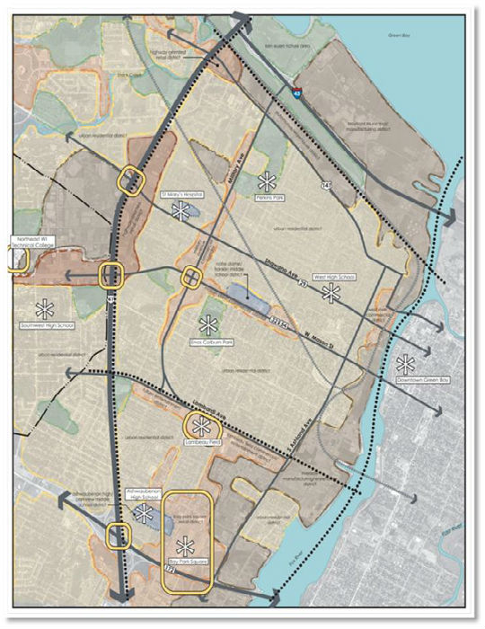
A series of maps was developed over the course of the project to illustrate key concepts including existing conditions, land use trends, sub district areas, zoning districts, redevelopment characteristics and future vision. These maps were used at the four public meetings, and also included in the final document.


